
Flood Zone Designations on the South Shore: What Homeowners Need to Know

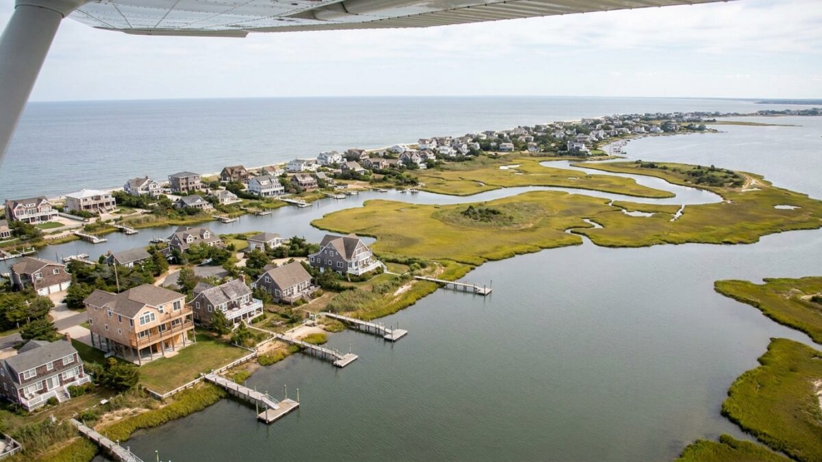
For homeowners on Long Island’s South Shore, flood zone designations shape nearly every aspect of property ownership. These classifications, established by the Federal Emergency Management Agency, determine insurance requirements, influence property values, and dictate what renovations require special permits. Understanding your zone means understanding both your financial obligations and your actual flood risk.
FEMA maps divide the South Shore into distinct flood zones based on statistical probability of flooding. The agency calculates these probabilities using historical data, topography, and coastal modeling. Every property falls into a designated zone, and that letter-number combination carries significant practical consequences.
The Core Zone Categories
Zone designations follow a hierarchy based on flood risk. High-risk areas carry different requirements than moderate or minimal-risk zones, and the distinctions matter for both current homeowners and prospective buyers.
Special Flood Hazard Areas, marked as Zones A and V, face the highest risk. These properties sit in areas with a one percent annual chance of flooding, commonly called the 100-year floodplain. Despite the name, this designation means a home in these zones has roughly a 26 percent chance of experiencing flood damage during a typical 30-year mortgage period.
Zone V specifically identifies coastal areas subject to wave action and velocity hazards. Properties in V zones face stricter building standards than inland A zones. Many South Shore waterfront communities fall into V zone classifications, particularly along barrier islands and direct oceanfront parcels.
Zone AE, a subcategory within high-risk areas, includes base flood elevation data. This number indicates how high floodwaters are expected to rise during that one-percent-annual-chance flood event. Base flood elevation determines how high structures must be elevated to meet current building codes.
Moderate and Minimal Risk Designations
Zone X represents areas of moderate to minimal flood risk. Properties in shaded Zone X face flooding chances between 0.2 and one percent annually. Unshaded Zone X areas have less than 0.2 percent annual flood risk.
The distinction between shaded and unshaded X zones affects both insurance costs and lending requirements. While flood insurance remains optional in X zones for properties without federally backed mortgages, many homeowners in shaded X zones choose coverage given their elevated risk compared to unshaded areas.
Some South Shore properties sit in Zone D, where flood hazards remain undetermined. These areas typically lack the detailed analysis required for more specific designations. Lenders and insurers often treat D zones with caution, sometimes requiring insurance or additional documentation.
Insurance Requirements and Costs
Federal law mandates flood insurance for properties in Special Flood Hazard Areas with mortgages from federally regulated or insured lenders. This requirement applies to new mortgages and continues throughout the loan term. Homeowners who pay off mortgages in high-risk zones may legally drop coverage, though doing so exposes them to substantial financial risk.
Insurance premiums vary dramatically by zone. A home in Zone X might pay a few hundred dollars annually for coverage. That same coverage in Zone V could cost several thousand dollars, particularly for properties below base flood elevation.
The National Flood Insurance Program provides most flood coverage on the South Shore. Private flood insurance has expanded in recent years, sometimes offering competitive rates for lower-risk properties. However, private policies may provide different coverage terms than NFIP policies, requiring careful comparison.
Properties built before communities adopted FEMA flood maps, called pre-FIRM structures, often face higher premiums than newer homes constructed to current elevation standards. A pre-FIRM home sitting below base flood elevation in Zone AE typically carries significantly higher insurance costs than a compliant newer home in the same zone.
Building and Renovation Requirements
Flood zone designations directly affect what homeowners can build and how they must build it. Communities participating in the NFIP must enforce floodplain management regulations, and local building departments verify compliance before issuing permits.
New construction and substantial improvements in Special Flood Hazard Areas must meet elevation requirements. Structures in A zones typically require lowest floors elevated to or above base flood elevation. V zones impose stricter standards, requiring elevation on pilings or columns, with breakaway walls for enclosed areas below.
Substantial improvement triggers these requirements even for existing homes. If renovation costs exceed 50 percent of the structure’s pre-improvement market value, the entire building must be brought into compliance with current standards. This threshold catches many homeowners by surprise during major renovations.
Local building officials determine substantial improvement on a project-by-project basis. Some communities track cumulative improvements over rolling time periods, meaning multiple smaller projects might collectively trigger the threshold even if individual renovations stay below 50 percent.
Property Values and Market Considerations
Flood zone designations influence South Shore property values in complex ways. Waterfront location drives premium pricing, but high insurance costs and building restrictions create downward pressure. Buyers increasingly factor long-term flood risk and insurance expenses into purchase decisions.
Properties elevated to current standards often command higher prices than comparable non-compliant homes. An elevated house in Zone V with low insurance premiums may sell for more than a similar non-elevated property, even when the elevated home required significant construction investment.
Disclosure requirements vary, but sellers must typically reveal known flood history and zone designations. Title companies and real estate attorneys routinely request flood zone determinations during transactions. Buyers frequently make insurance cost estimates part of their purchase analysis.
Map Updates and Appeals
FEMA periodically updates flood maps to reflect new data, changed coastal conditions, and improved modeling. Map revisions can shift properties between zones, suddenly making previously moderate-risk homes high-risk or vice versa.
Property owners may challenge their flood zone designations through the Letter of Map Amendment or Letter of Map Revision processes. These applications require surveyor documentation showing a property sits above base flood elevation or that FEMA mapping contains errors. Successful appeals can lower insurance costs substantially, though the process requires professional documentation and fees.
Communities can also request map revisions when they complete flood control projects or when they believe FEMA data no longer reflects actual conditions. These community-wide changes take years to complete but can affect numerous properties simultaneously.
Practical Steps for Homeowners
Every South Shore homeowner should verify their property’s current flood zone designation through FEMA’s online map service center. Zone letters appear on official flood maps, and many municipal building departments provide zone information on request.
Homeowners should obtain elevation certificates if none exists for their property. These surveyor-prepared documents show how the structure relates to base flood elevation and often reduce insurance premiums when they demonstrate favorable elevation.
Even property owners outside Special Flood Hazard Areas should consider flood insurance. Roughly 25 percent of flood insurance claims come from moderate-to-low-risk areas. Flooding occurs outside mapped high-risk zones, and coverage in X zones costs substantially less than in A or V zones.
Understanding flood zones means understanding both regulatory requirements and actual physical risk. The South Shore’s geography makes flooding a permanent consideration for coastal homeowners, and zone designations provide the framework for managing that reality through insurance, building standards, and informed property decisions.